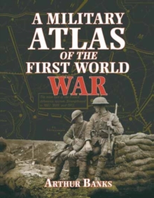
Image for A military atlas of the First World War

A military atlas of the First World War

See all formats and editions

This is a unique study of the conflict of 1914-18 on land, sea and in the air, through maps, diagrams and illustrations.

Within the scope of some 250 maps, Arthur Banks has presented both broad general surveys of political and military strategy, and the most closely researched details of major individual campaigns and engagements.

These are supplemented by comprehensive analysis of military strengths and command structures and illustrations.

Read More
Available
£14.99 Save 25.00%
RRP £19.99
Add Line Customisation
4 in stock Need More ?
Add to List
Product Details
Pen & Sword Books Ltd
0850527910 / 9780850527919
Paperback / softback
940.4
13/09/2000
United Kingdom
English
xi, 337 pages : illustrations (black and white), chiefly maps (black and white)
25 cm
general Learn More
Reprint. Originally published: London: Heinemann Educational, 1975.