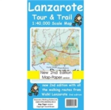
Image for Lanzarote Tour and Trail Map Map-Paper Version

Lanzarote Tour and Trail Map Map-Paper Version (2 Rev ed)

Part of the Tour & trail maps series
See all formats and editions

Lanzarote Tour & Trail Map 2nd edition Map-Paper version covers this big island at a scale of 1:40,000 resulting in the most detailed and toughest map of Lanzarote that you can buy.

All the country walking routes from our new Walk! Lanzarote 2nd edition (published August 2009) are clearly detailed.

Detailed updating for the 2nd edition includes mapping Puerto del Carmen's new golf course and inner bypass, Playa Blanca's urban/incomplete development, as well as the new walking routes.

We have also included a full island map of La Graciosa at 1:40,000 scale for those people adventuring or staying on the island. Digital editions of this map are available for use on mobile phone apps from Viewranger, Memory Map and MyTrails, plus versions for mapping gps units and gps software are available from Mapyx Quo and Memory Map.

Getting such a large island onto one map sheet at 1:40,000 scale means that we have had to split the island into a North-East section on one side and a South-West section on the other side, with a generous overlap between the sections.

At 1:40,000 scale the level of detail we can include on the map is awesome compared to any other map of the island that you can buy. In addition to the usual high level of detail on our Tour & Trail Maps we have introduced special Lava fills to define the lava fields and a Zocos fill to define the famous La Geria region.

The result is the definitive map of Lanzarote. Our Map-Paper version is printed on top quality map paper by Britain's top map printer.

If you require a tougher map then consider acquiring our Super-Durable version.

Read More
Title Unavailable: Out of Print
Product Details
Discovery Walking Guides Ltd
1904946542 / 9781904946540
Sheet map, folded
912.649
30/07/2009
United Kingdom
2 pages, 1:40,000 scale topographical map
120 x 220 mm
General (US: Trade) Learn More