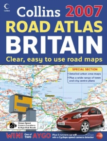
Image for Collins 2007 road atlas Britain  : clear, easy to use road maps

Collins 2007 road atlas Britain : clear, easy to use road maps

See all formats and editions

This title presents main road maps at 3.2 miles to 1 inch scales.

The ultimate large format road atlas for the year 2007, featuring the well respected Collins mapping; designed for exceptional clarity and ease of use.

A key feature is the wide range of urban area maps. There are also over 60 city and town centre street plans.

It includes speed camera locations. It includes fully updated road mapping, covering the whole of Britain.

The atlas includes a wide range of urban area maps, which are ideal for planning routes into and through major towns and cities.

There is also a route planning map of Ireland. There are a number of new features for 2007 including speed camera locations, blue flag beaches and freight terminals, plus motorway slip roads.

It includes: route planning maps of Britain and Ireland at 15.8 miles to 1 inch (1:1,000,000) and limited access junction information; main maps at 3.2 miles to 1 inch (1:200,000); Northern Scotland at 5 miles to 1 inch (1:316,800); through-route maps at 1 inch to 1 mile (1:63,360) for over 20 urban areas; comprehensive selection of over 60 town and city centre maps; park and ride locations shown for major cities and towns; motorway services guide with information on facilities; blue flag beaches; and full index to place names and places of interest. It is of interest to any driver of any vehicle who requires the latest information, the most complete coverage and the clearest detail of any road atlas.

Read More
Title Unavailable: Out of Print
Product Details
Collins
0007224974 / 9780007224975
Paperback
912.41
07/08/2006
United Kingdom
English
xv, 160 p.
39 cm
general Learn More
/ Key title Main road maps at 3.2 miles to 1 inch. The ultimate large format road atlas for the year 2007, featuring the well respected Collins mapping; designed for exceptional clarity and ease of use. A key feature is the wide range of urban area maps. There are also over 60 city and town centre street plans. Includes speed camera locations. / Mapping includes speed camera locations. / Fully updated for 2007 with all the latest road changes. / Wide range of map scales makes light work of route planning. / Unparalleled range of urban area through-route maps at 1 inch to 1 mile. / Popular 'flo
/ Key title Main road maps at 3.2 miles to 1 inch. The ultimate large format road atlas for the year 2007, featuring the well respected Collins mapping; designed for exceptional clarity and ease of use. A key feature is the wide range of urban area maps. There are also over 60 city and town centre street plans. Includes speed camera locations. / Mapping includes speed camera locations. / Fully updated for 2007 with all the latest road changes. / Wide range of map scales makes light work of route planning. / Unparalleled range of urban area through-route maps at 1 inch to 1 mile. / Popular 'flo 1DBK United Kingdom, Great Britain, WTR Travel maps & atlases