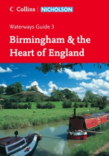
Image for Collins/Nicholson waterways guide3,: Birmingham & the Heart of England

Collins/Nicholson waterways guide3,: Birmingham & the Heart of England - No. 3 : Birmingham & the Heart of England (New ed)

Part of the Waterways Guide S. series
See all formats and editions

Colour maps clearly showing locks, towpaths and boating facilities as well as comprehensive navigational notes.

First published in the 1970s, the "Collins/Nicholson" guides to the waterways are designed for anyone and everyone with an interest in Britain's inland waterways - experienced boaters and those planning their first boat trip, walkers, cyclists and visitors.

Maps show: locks, bridges, tunnels, aqueducts, winding holes and the towpath; waterpoints, sanitary stations, pump out facilities and refuse disposal; boatyards, pubs, restaurants and shops; mile markers and milestones (distance in miles and number of locks to strategic points along the waterways).

Text includes: the history of each canal; local services and places of interest, pubs and restaurants; opportunities for walking and cycling.

Comprehensive navigational notes include: maximum dimensions and low bridges; mileages, advice and potential hazards; navigation authorities and contact details. Waterways covered in this guide - Ashby Canal, Birming Canal Navigations (Main Line), Birmingham and Faxeley Canal, Coventry Canal, Erewash Canal, Grand Union Canal (Main Line, Leicester Section and the River Soar), Oxford Canal, Staffordshire and Worcestershire Canal, Stratford-on-Avon Canal, Worcester and Birmingham Canal, Trent and Mersey Canal.

Read More

The title has been replaced.To check if this specific edition is still available please contact Customer Care +44(0)1482 384660 or schools.services@brownsbfs.co.uk, otherwise please click 9780007538997 to take you to the new version.

£11.19 Save 20.00%
RRP £13.99
This title has been replaced View Replacement
Product Details
OS-Nicholson
0007211112 / 9780007211111
Spiral bound
06/03/2006
United Kingdom
English
176 p. : col. ill., col. maps
21 cm
general Learn More
Previous ed.: published as Nicholson guide to the waterways. London: Nicholson, 2003.
Colour maps clearly showing locks, towpaths and boating facilities as well as comprehensive navigational notes. / Comprehensive, detailed information for boaters. / Includes newly opened stretches of waterway. / Designed for everyone with an interest in Britain's canals and rivers. / Over 415 million visits are made to Britain's waterways each year -- 2 million by boaters and their passengers; 100,000 by people visiting waterway events. / Collins/Nicholson guides have logical groupings of waterways: recognised circular routes are contained within single editions.
Colour maps clearly showing locks, towpaths and boating facilities as well as comprehensive navigational notes. / Comprehensive, detailed information for boaters. / Includes newly opened stretches of waterway. / Designed for everyone with an interest in Britain's canals and rivers. / Over 415 million visits are made to Britain's waterways each year -- 2 million by boaters and their passengers; 100,000 by people visiting waterway events. / Collins/Nicholson guides have logical groupings of waterways: recognised circular routes are contained within single editions. 1DBKEN North West England, WGGN Narrowboats & canals, WTR Travel maps & atlases