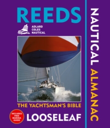
Image for Reeds looseleaf nautical almanac 2007

Reeds looseleaf nautical almanac 2007

Featherstone, Neville(Edited by)Lambie, Peter(Edited by)
See all formats and editions

"The Reeds Oki Looseleaf Almanac" is a versatile system that combines almanac and pilotage information in a convenient looseleaf form.

The unique looseleaf format, bound inside a durable binder which stays open on the chart table, lets the user tailor the almanac to their needs by complementing the contents supplied with whatever information they may want to add or take out.

The looseleaf format makes information access quick and easy while allowing the navigator to easily refresh it with the annual update pack.

Covering the entire European Atlantic coastline from the tip of Denmark right down to Gibraltar, this is a highly convenient compendium of navigational data for all leisure and professional boaters: 700 port plans, tide tables and tidal streams, distance tables, 7500 waypoints, harbour facilities, pilotage advice, safety, first aid, navigation, radio, lights, weather forecasts around the UK and European waters, collision regulations, communications, distress situations, light recognition, rescue services, and Mayday procedures.

Also available are: free supplements of up-to-date navigation changes.

Read More
Title Unavailable: Out of Print
Product Details
Thomas Reed Publications
0713678291 / 9780713678291
Paperback
528.84
07/11/2006
United Kingdom
English
1048 p. : col. ill.
27 cm
general Learn More
In ringbinder.
Covers the British Isles, Ireland, France, Channel Islands, Belgium, Germany, Netherlands, Denmark, Spain & Portugal - including the Azores for the first time Extensive coverage of smaller ports with additional chartlets Four colour plans and illustrations throughout Updatable value-for-money system in a convenient lie-flat format Complete with a durable binder, which stays open on the chart table Allows the user to tailor their content with whatever data they want to add or remove Comes with free Marina and Waypoint Guide
Covers the British Isles, Ireland, France, Channel Islands, Belgium, Germany, Netherlands, Denmark, Spain & Portugal - including the Azores for the first time Extensive coverage of smaller ports with additional chartlets Four colour plans and illustrations throughout Updatable value-for-money system in a convenient lie-flat format Complete with a durable binder, which stays open on the chart table Allows the user to tailor their content with whatever data they want to add or remove Comes with free Marina and Waypoint Guide GBCY Yearbooks, annuals, almanacs, TRLN Navigation & seamanship, WSSN Boating