Image for Mapping my country

Mapping my country

Part of the Mapping series
See all formats and editions

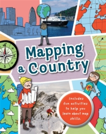
Full of hands-on activities to help you learn all about map skills whilst also learning about the features of the UK.

This book will show you what a bird's-eye map is by looking at aerial photos; how landmarks can be shown as symbols; how to measure scale and distance; what map plans are; how compass points show you how to find directions; how to follow pathways and roads; how to use grid references; looking at landuse; and looking at transport maps. Illustrations by Sarah Horne in an amusing and lively style are combined with photographs to really capture a child's attention helping them to learn these important map skills.

Read More
Title Unavailable: Out of Print
Product Details
Wayland (Publishers) Ltd
0750291931 / 9780750291934
Paperback / softback
526
10/08/2017
United Kingdom
English
32 pages : illustrations (colour), maps (colour)
27 cm
Children / Juvenile Learn More
Reprint. Originally published: 2015.