Image for World travel atlas

World travel atlas

See all formats and editions

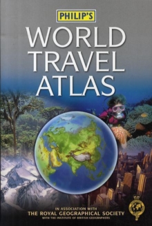
The compact-format "Philip's World Travel Atlas" has been specially created for the long-haul traveller, whether on business or pleasure, from the latest digital cartography.

It has been fully revised for 2006, showing the new names for Pretoria (Tshwane) and Durban (eThekwini) in South Africa.

At the beginning of the atlas is an informative travel section, now expanded by 8 pages, which includes maps of time zones, world air routes and world climate, together with 24 major city plans arranged in alphabetical order for ease of reference.

New for this second edition are city maps of Dublin, Moscow, Prague and Toronto.

Next, a concise Gazetteer of Nations provides up-to-date information for 150 of the world's countries (an additional 24 entries are included compared to the previous edition), with key facts on currencies, languages, governments, plus current medical and travel advice. The additional entries in the Gazetteer for this new edition are: American Samoa, Anguilla, Antigua and Barbuda, Aruba, Belize, Cape Verde, Comoros, Dominica, Ethiopia, French Polynesia, Grenada, Guadeloupe, Madagascar, Mauritius, Netherlands Antilles, Reunion, St Kitts and Nevis, St Lucia, St Vincent and the Grenadines, Samoa, Slovak Republic, Trinidad and Tobago, British Virgin Islands and US Virgin Islands.

The 96 pages of up-to-date world maps are physically coloured to give a superb representation of the Earth's surface, with cities and towns, as well as major road and rail transport routes and airports, clearly shown.

At the end of the atlas, the 64-page letter-figure index lists all major towns and cities, plus numerous geographical features such as mountains, rivers and lakes.

The compact paperback format of this atlas makes it ideal for travellers of all kinds, both at the planning stage and en route.

Read More
Title Unavailable: Out of Print
Product Details
Philip's
0540088935 / 9780540088935
Paperback
912
10/04/2006
United Kingdom
English
160 p. : col. ill.
24 cm
general Learn More
Map on inside covers.