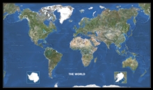
Image for World Photo Satellite Map

World Photo Satellite Map

Michelin(Edited by)
Part of the Michelin Wall Maps series
See all formats and editions

This map is of size - 146cm x 87cm and is presented on a scale of 1:28,500,000.

Both educational and decorative, it is ideal for use in both home and office.

More than 7,500 Landsat images are used to create this map.

It also includes country names and capital cities, as well as, all hanging attachments.

It is presented in a plastic tube.

Read More
Title Unavailable: Out of Print
Product Details
Michelin Maps
2067127578 / 9782067127579
Sheet map, rolled
912
31/10/2006
United Kingdom
1 pages, Colour Mapping
73 x 1037 mm, 544 grams
General (US: Trade) Learn More