Image for France at a glance

France at a glance

See all formats and editions

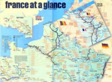
"France at a Glance" is a waterway map of France showing the entire canal and river system with all its links and interchanges (as well as closed sections), enabling users to see at a glance distances, interlinks, nearness to towns, heights of bridges, number of locks, facilities and places of interest on a particular stretch of waterway.

The French waterways are a very popular destination for boat owners and hirers, and this map of the entire system should be valuable to anyone planning a visit.

Read More
Title Unavailable: Out of Print
Product Details
Adlard Coles Nautical
0713669020 / 9780713669022
Sheet map, folded
01/01/2004
United Kingdom
English
on sheet 30 x 21 cm
general Learn More