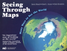
Image for Seeing through maps  : many ways to see the world

Seeing through maps : many ways to see the world

See all formats and editions

Do you know: Which image shows population sizes? Which images show how big each country is? Which image shows that 'North' isn't the same as 'up'?

Which image conveys the idea of 'Spaceship Earth'? Which image was created to help navigators? Which images have been criticized the most? This book answers all these questions and many more.

It explains the principles behind the Peters' Projection Map and a dozen other unique maps and provocative images.

It includes over 70 maps and illustrations, including a redrawing of Mercator's original world map (unavailable since the 1950s), Minard's map of Napoleon's march on Moscow, and routes of African Slave Trading.

Read More
Title Unavailable: Out of Print
Product Details
1904456553 / 9781904456551
Paperback
526.8
11/01/2007
United Kingdom
English
viii, 152 p. : ill.
22 x 28 cm
general Learn More
Originally published: Amherst, Mass.: ODT, 2001. Ill. and text on inside cover.