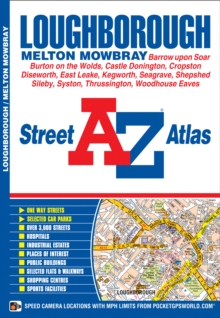
Image for Loughborough A-Z Street Atlas

Loughborough A-Z Street Atlas (New Fifth edition)

See all formats and editions

This A-Z map of Loughborough features 38 pages of coloured street mapping covering:*Castle Donington*East Midlands Airport*Kegworth*Hathern*Barrow upon Soar*Quorndon*Sileby*East Goscote*Queniborough*Syston*Mountsorrel*Woodhouse Eaves*Shepshed*Diseworth (inset). There is separate coverage of Melton Mowbray, East Leake and Bourton on the Wolds. Postcode districts, one-way streets and safety camera locations with maximum speeds are featured on the mapping. The index section of the atlas lists streets, selected flats, walkways and places of interest, place, area and station names, hospitals and hospices covered by this atlas.

Read More
Title Unavailable: Out of Print
Product Details
Geographers' A-Z Map Co Ltd
1782570667 / 9781782570660
Paperback / softback
06/05/2015
United Kingdom
52 pages
149 x 215 mm, 100 grams
General (US: Trade) Learn More