Image for Big Easy Read France 2015

Big Easy Read France 2015

See all formats and editions

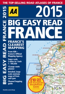
Fully revised and updated for 2015, this specialist easy-to-read, A3 road atlas designed for the British motorist in France includes 44 city, town and port plans central Paris city plan and district maps of Paris and Lyon.

Coverage includes road mapping for Corsica plus there is a channel hopping guide, channel tunnel terminal and channel tunnel port plans. Features include: 12-page route planner; detailed, large scale environs maps of Paris and Lyon; channel hopping guide; over 18,500 tourist sites shown on the mapping plus French place names used to match local road signs.

Read More
Title Unavailable: Out of Print

The title has been replaced.To check if this specific edition is still available please contact Customer Care +44(0)1482 384660 or schools.services@brownsbfs.co.uk, otherwise please click 9780749582234 to take you to the new version.

This title has been replaced View Replacement
Product Details
Automobile Association
0749576650 / 9780749576653
Spiral bound
912.44
15/12/2014
United Kingdom
English
1 atlas (272 pages) : colour
40 cm
General (US: Trade) Learn More