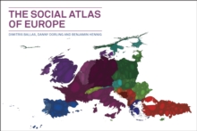
Image for The social atlas of Europe

The social atlas of Europe

See all formats and editions

CHOICE OUTSTANDING ACADEMIC TITLE 2015Many of us think of European countries as discreet entities-their own languages, cultures, food, and economies squarely contained within their national boundaries.

But in fact Europe is at once a unified place and a sophisticatedly fragmented one, and national boundaries rarely reflect its social and economic realities.

The social atlas of Europe is the first atlas to map Europe according to these realities, from the perspective of human geography rather than simply a political one. Using innovative full-color visualization methods, it reconsiders European identity through its many different facets: economy, culture, history, and human and physical geography, visualizing Europe and its people in a more fluid way, in some cases using maps without artificial national boundaries.

It utilizes the latest available demographic, social, and economic data through state-of-the-art geographical information systems and new cartography techniques.

Through these new visualizations, this highly illustrated book offers fresh perspectives on a range of topics, including social values, culture, education, employment, environmental footprints, health and well-being, and social inequalities and cohesion.

It is a bold rethinking of Europe as we know it and will be of interest to anyone who wants to understand the continent in its truest form.

Read More
Special order line: only available to educational & business accounts. Sign In
£63.99 Save 20.00%
RRP £79.99
Product Details
Policy Press
1447313534 / 9781447313533
Hardback
25/06/2014
United Kingdom
English
ix, 211 pages : maps (colour)
20 x 28 cm
Postgraduate, Research & Scholarly Learn More