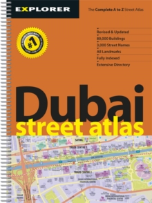
Image for Dubai Street Atlas

Dubai Street Atlas

See all formats and editions

A comprehensive A to Z of Dubai's ever-growing road network, with a thorough index giving the exact location of every street, every hotel, every shopping centre, every landmark, and every major residential and commercial building.

Each map spread features a satellite image of the featured area on one page, opposite a detailed vector map of the same area.

Amusement Centres Aquariums Art Galleries Banks & ATMs Bars & Nightclubs Beaches & Parks Cafes Cinemas Consulates Embassies Golf Courses Health Spas Hospitals Hotels Metro Stations Museums Nurseries Petrol Stations Restaurants Schools Shopping Malls Sports Clubs Theatres Universities

Read More
Title Unavailable: Out of Print
Product Details
Explorer Publishing
9948450132 / 9789948450139
Sheet map, folded
12/02/2015
United Arab Emirates
350 pages
General (US: Trade) Learn More