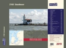
Image for Imray Chart Atlas 2160 : IJsselmeer Chart Atlas 2019

Imray Chart Atlas 2160 : IJsselmeer Chart Atlas 2019 (New ed)

Part of the 2000 series
See all formats and editions

Part of Imray's popular small format chart coverage for the Netherlands, this atlas is a convenient A2 format, wirobound along one edge.

Includes extensive coverage of the IJsselmeer, Markermeer and Randmeren, as well as the Nordzeekanaal from IJmuiden to Amsterdam. "This 2019 edition has been fully updated throughout.

The latest depth surveys are displayed, as well as production works and development details."Charts in the atlas include1.

IJsselmeer Overview Chart (1:350 000)2. IJsselmeer - North sheet (1:85 000)3. IJsselmeer - South sheet (1:85 000)4. IJsselmeer Plans - Den Oever (1:25 000), Breezanddijk (1:20 000), C Kornwerderzand & Makkum (1:25 000), Hindeloopen (1:25 000), Stavoren (1:25 000), Oude Zeug (1:15 000), Lemmer (1:25 000), Medemblik (1:15 000), Andijk (1:20 000), Enkhuizen & Broekerhaven (1:15 000) and Urk (1:20 000)5.

Markermeer (1:85 000) includes plan Hoorn (1:15 000)6.

Gouwzee & Edam (1:35 000) and Lelystad (1:35 000) includes plans Edam (1:12 500), Volendam (1:15 000), Monnickendam (1:15 000), Marken (1:10 000), Uitdam (1:10 000), Houtribhoek (1:20 000)7.

Nordzeekanaal - IJmuiden to Amsterdam (1:50 000) includes plan IJmuiden (1:20 000)8.

Amsterdam (1:22 500)9. Markermeer South - Oranjesluis to Hollandsbrug (1:25 000)10.

Randmeren - Hollandse Brug to Nulde (1:40 000) includes plans Almere Haven (1:15 000), Huizen (1:15 000), Eemmond (1:15 000), Spakenberg (1:15 000), Nijkerk (1:15 000) and Nulde (1:15 000)11.

Randmeren - Nuldenauw Channel to Harderwijk (1:40 000) includes plans Harderwijk (1:20 000) and Zeewolde (1:20 000)12.

Randmeren - Veluwemeer to Ketelhaven (1:40 000) includes plans Bremerbergse Hoek (1:15 000), Elburg (1:20 000), Roggebotsluis (1:15 000)13.

Ketelmeer - Ketelbrug to Kampen (1:30 000) includes plans Continuation of IJssel to Kampen (1:40 000), Ketelhaven (1:15 000) and Kampen (1:15 000)14.

Zwarte Meer - Ramspolbrug to Hasselt (1:32 500) includes plans Genemuiden (1:15 000), Zwartsluis (1:15 000) and Hasselt (1:15 000)Imray Digital Charts: Free mobile download A voucher code to download ID80 Imray Netherlands charts into Imray Navigator (our app for iPad, iPhone and Android) is included with this atlas.

Read More
Title Unavailable: Out of Print
Product Details
1786790866 / 9781786790866
Sheet map, flat
912.492
United Kingdom
14 pages
840 x 590 mm, 660 grams