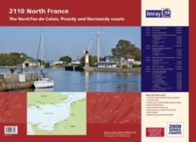
Image for Imray Chart Atlas 2110 : North France - Nord-Pas-de-Calais, Picardy and Normandy Coasts

Imray Chart Atlas 2110 : North France - Nord-Pas-de-Calais, Picardy and Normandy Coasts (2 New edition)

Part of the 2000 Series series
See all formats and editions

A new edition of the atlas North France, consisting of 6 double-sided sheets covering the coast from Nieuwpoort (Belgium) to Cherbourg.The atlas consists of the following:1.

Eastern English Channel (1:600 000)2. Dover Strait (1:200 000)3. Cap Gris-Nez to Dieppe (1:200 000)4. Nieuwpoort & Nord-Pas-de-Calais PlansA. Nieuwpoort (1:30 000), B. Rade de Dunkerque (1:125 000), C. Dunkerque (1:25 000), D. Calais (1:20 000), E. Boulogne-sur-Mer (1:25 000), F. Etaples (1:75 000)5. Dieppe to Le Havre (1:200 000)6. Picardy & Upper Normandy PlansA. Baie de Somme (1:75 000), B. Le Treport (1:12 500), C. Dieppe (1:12 500), D. St-Valery-en-Caux (1:12 500), E. Fecamp (1:12 500)7. Approaches to Le Havre & River Seine (1:60 000)8. River Seine PlansA. Le Havre (1:17 500), B. River Seine to Tancarville (1:63 000), C. Honfleur (1:12 500)9. Baie de Seine (East) (1:155 000)10. Baie de Seine (West) to Cherbourg (1:155 000)11. Lower Normandy PlansA. Deauville/Trouville (1:15 000), B. Dives-sur-Mer (1:30 000), C. Ouistreham (1:25 000), D. Courseulles-sur-Mer (1:20 000), E. Arromanches (1:35 000), F. Port-en-Bessin (1:10 000), G. Grandcamp-Maisy (1:6000), H. Baie du Grand Vey (1:75 000), I.Saint-Vaast-la-Hougue (1:20 000), J. Barfleur (1:15 000), K. Cherbourg (1:40 000), L. Port Chantereyne (Cherbourg) (1:10 000), M. Omonville-la-Rogue (1:7000)

Read More
Available
£36.00 Save 20.00%
RRP £45.00
Add Line Customisation
Usually dispatched within 4 weeks
Add to List
Product Details
1846238595 / 9781846238598
Sheet map, flat
797.124
01/02/2017
United Kingdom
General (US: Trade) Learn More