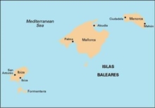
Image for Imray Chart M3

Imray Chart M3 : Islas Baleares

See all formats and editions

Plans included: San Antonio (Ibiza) (1:30 000) Puerto de Ibiza (1:15 000) Puerto de Palma (Mallorca) (1:17 500) Porto Colom (Mallorca) (1:10 000) Puerto de Mahon (Menorca) (1:20 000) Alcudia (Mallorca) (1:20 000) Approaches to Ciudadela (Menorca) (1:10 000) For this 2014 edition the chart has been fully updated throughout using revised depth data.

Harbour/marina developments are shown at San Antonio (Ibiza), Puerto de Ibiza, Puerto de Palma (Mallorca) and Ciudadela (Menorca); and new entrance buoyage is shown at Porto Colom (Mallorca).

Read More
Title Unavailable: Out of Print

The title has been replaced.To check if this specific edition is still available please contact Customer Care +44(0)1482 384660 or schools.services@brownsbfs.co.uk, otherwise please click 9781786790194 to take you to the new version.

This title has been replaced View Replacement
Product Details
184623624X / 9781846236242
Sheet map, folded
01/07/2014
United Kingdom
1 pages
210 x 295 mm
General (US: Trade) Learn More