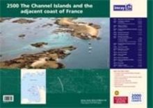
Image for Imray Chart Pack 2500 : Channel Islands

Imray Chart Pack 2500 : Channel Islands

See all formats and editions

A completely revised edition of the 2500 chart pack, now consisting of 9 double-sided sheets to cover the Channel Islands and adjacent coast of France in detail. This replaces the old edition and component charts of 2500 The Channel Islands which are no longer supported by corrections. The pack consists of the following: 2500.1 Approaches to the Channel Islands (1:500,000) 2500.2 Cap Barfleur to Alderney (1:150,000) A Cherbourg (1:40,000) B Port de Chantereyne (Cherbourg) (1:10,000) 2500.3 Alderney & Burhou (1:25,000) A Alderney Harbour (1:12,500) 2500.4 Passages between Alderney & Guernsey (1:150,000) A Dielette (1:15,000) 2500.5 Guernsey, Herm & Sark (1:60,000) 2500.6 East Guernsey & Herm (1:25,000) 2500.7 Guernsey & Sark Plans A St Peter Port & Havelet Bay (1:6,000) B Beaucette Marina (1:10,000) C Sark Anchorages (1:25,000) D Guernsey - South Coast Anchorages (1:25,000) 2500.8 Passages between Guernsey & Jersey (1:150,000) A Carteret (1:25,000) 2500.9 Jersey & Les Ecrehou (1:75,000) 2500.10 Approaches to St Helier (1:30,000) A St Helier Harbour (1:15,000) 2500.11 East Coast of Jersey (1:25,000) 2500.12 Jersey to Granville (1:150,000) A Granville (1:20,000) 2500.13 Plateau des Minquiers (1:50,000) 2500.14 Plateau des Minquiers to St-Malo (1:150,000) A St-Malo (1:55,000) 2500.15 Illes Chausey (1:30,000) 2500.16 St-Malo & La Rance (1:15,000) includes continuation to Lyvet (1:25,000)

Read More
Title Unavailable: Out of Print

The title has been replaced.To check if this specific edition is still available please contact Customer Care +44(0)1482 384660 or schools.services@brownsbfs.co.uk, otherwise please click 9781786793911 to take you to the new version.

This title has been replaced View Replacement
Product Details
1846236126 / 9781846236129
Sheet map, flat
28/03/2014
United Kingdom
15 pages
490 x 420 mm
General (US: Trade) Learn More