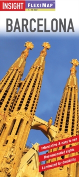
Image for Insight Flexi Map: Barcelona

Insight Flexi Map: Barcelona (4 ed)

Part of the Insight Flexi Maps series
See all formats and editions

Flexi Map Barcelona is laminated, tear-resistant and includes 3 separate maps, each map has its own index which has been categorised for ease of use.

It includes a list - with descriptions and some photographs - of 25 recommended sights, divided by theme and linked to the mapping by numbered markers.

There is also a handy information section with concise details on getting around, tourist offices, money, tipping, opening times, public holidays, telecommunications, emergency telephone numbers and climate.

The main map is of Barcelona at a scale of 1:15 000 (1cm = 0.15km), coverage includes the Camp Nou football stadium.

One way streets, car parks, pedestrian zones, and public transport routes are clearly shown.

Many prominent public buildings, hotels and other places of interest are highlighted and listed in the extensive index.

A separate Metro map is located on the back cover for easy reference.

The reverse side includes an extremely detailed map of the Old City, at 1:7 000 (1cm = 0.07km), together with a map of the Barcelona Area at a scale of 1:120 000 (1cm = 1.2km).

Read More
Title Unavailable: Out of Print

The title has been replaced.To check if this specific edition is still available please contact Customer Care +44(0)1482 384660 or schools.services@brownsbfs.co.uk, otherwise please click 9781786715609 to take you to the new version.

This title has been replaced View Replacement
Product Details
Insight Guides
1780053924 / 9781780053929
Sheet map
16/01/2015
United Kingdom
2 pages
102 x 220 mm, 59 grams
General (US: Trade) Learn More