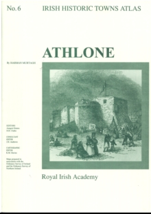
Image for Athlone : Irish Historic Towns Atlas, no. 6

Athlone : Irish Historic Towns Atlas, no. 6

Part of the Irish Historic Towns Atlas series
See all formats and editions

Number 6 of the Irish Historic Tows Atlas series, this fascicle illustrates characteristic periods of Athlone’s cultural formation and its topographical history.

It illuminates points in the development of a strategic town on the River Shannon in County Westmeath.

The folder contains a coloured map; eight pages of black and white maps and plates and 16 pages of text where the history of over 700 sites are traced.

Series editors: Anngret Simms, H.B. Clarke; Consultant editor: J.H. Andrews; Cartographic editor: K.M. Davies

Read More
Available
£20.00
Add Line Customisation
Usually dispatched within 2 weeks
Add to List
Product Details
Royal Irish Academy
1874045135 / 9781874045137
Sheet map, folded
07/01/1994
Ireland
25 pages, Maps; Illustrations, unspecified
305 x 410 mm, 397 grams