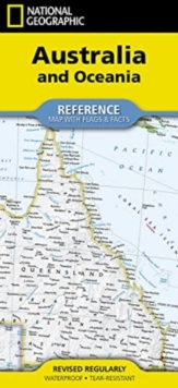
Image for National Geographic Australia and Oceania Map (Folded with Flags and Facts)

National Geographic Australia and Oceania Map (Folded with Flags and Facts) (2022nd ed.)

Part of the National Geographic Reference Map series
See all formats and editions

Waterproof Tear-Resistant Reference Map. Expertly researched and designed, National Geographic's Australia and Oceania Flags and Facts Map is the authoritative map of Australia by which other reference maps are measured.

The map side includeds a political map showing countries, cities and other landmarks and a physical map shows the landforms such as mountain ranges and rivers.

The Flags & Facts side includes an overview map of Oceania, the section of the Pacific Ocean stretching from New Zealand to the Galapagos Islands. Clearly defined boundaries, major cities, and physical featuresHundreds of place names carefully placed to maintain legibility in heavily populated areasIncludes Australia and Oceania and adjacent regions of AsiaDetailed physical map of Australia with mountain ranges, plains, lakes, and riversFlags and facts with detailed information about cultural and physcial attributesPrinted in the U.S.A. on extremely durable, waterproof, and tear-resistant materialThis Reference Map is printed on durable synthetic paper, making it waterproof, tear-resistant and tough - capable of withstanding the rigors of any kind of use in the home or classroom.

Read More
Special order line: only available to educational & business accounts. Sign In
£11.19 Save 20.00%
RRP £13.99
Product Details
National Geographic Maps
1566959314 / 9781566959315
Other cartographic
01/05/2024
United States
2 pages, 2 Maps
108 x 235 mm, 54 grams