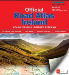
Image for Official Road Atlas Ireland

Official Road Atlas Ireland

See all formats and editions

This edition contains updated road maps covering Ireland, plus City and Town Maps and Motoring Information, Distance Charts and Extensive Gazetteer (Index of Towns). This new 8th edition is published in conjunction with Ordnance Survey Northern Ireland and the Road Safety Authority (RSA) and features Collision Zones, Speed Detection Zones and Tolled Roads. (This product is produced with the co-operation of Ordnance Survey Northern Ireland, OSNI).

Read More
Available
£11.99 Save 20.00%
RRP £14.99
Add Line Customisation
34 in stock Need More ?
Add to List
Product Details
Ordnance Survey Ireland
1912140470 / 9781912140473
Paperback / softback
912.415
09/04/2021
United Kingdom