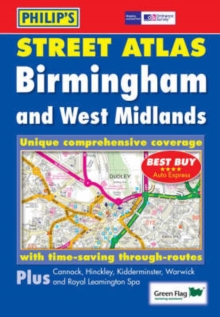
Image for Philip's Street Atlas Birmingham and West Midlands

Philip's Street Atlas Birmingham and West Midlands : Pocket

See all formats and editions

A brand new edition of this successful colour atlas of Birmingham & West Midlands, giving the most comprehensive and detailed coverage of the region.

No other atlas names every street in Birmingham & West Midlands.The mapping is produced by the Ordnance Survey to our specification and gives the user complete coverage of all urban and rural areas.

The mapping is at a standard scale of 3 1/2 inches to 1 mile, 2 1/2 inches to 1 mile in the pocket edition, and is complete with postcode boundaries.The atlas is ideally suited for both business and leisure use.

There is a route-planning map and an administrative and postcode map at the front of the atlas.

The main maps show every named road, street and lane clearly with through-routes highlighted.

School locations are marked and emergency services, hospitals, police stations, car parks and rail and bus station locations are all featured.

There is a comprehensive index of street names and postcodes that includes schools, industrial estates, hospitals, sports centres, etc, which are highlighted in colour.Main map scale: 2 1/2 inches to 1 mile

Read More
Title Unavailable: Out of Print

The title has been replaced.To check if this specific edition is still available please contact Customer Care +44(0)1482 384660 or schools.services@brownsbfs.co.uk, otherwise please click 9781849071413 to take you to the new version.

This title has been replaced View Replacement
Product Details
Philip's
0540088374 / 9780540088379
Paperback
24/04/2006
United Kingdom
264 pages
144 x 206 mm, 394 grams
General (US: Trade) Learn More