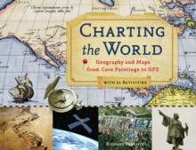
Image for Charting the World: Geography and Maps from Cave Paintings to GPS with 21 Activities

Charting the World: Geography and Maps from Cave Paintings to GPS with 21 Activities

See all formats and editions

Maps have been a part of human culture since the days of scratching on cave walls, and this richly illustrated history chronicles the road from simple diagrams used to avoid danger to the complex, navigational charts used today.

Displaying an array of historic atlases and a variety of cartography styles, this book allows young readers to test their map-reading skills while discovering the intricate beauty and the wealth of information held within.

Geographical concepts are spotlighted through an assortment of guided activities--including finding the elevation of hills, plotting a course with a magnetic compass, creating three-dimensional land models using a contour map, and performing a plot survey.

Drawing the conclusion that the study of geography and maps is crucial to understanding an ever-changing planet, this handbook discloses the ways in which technological advances in cartography can further discussions on climate change, warfare, environmental conservation, population growth, and other timely topics.

Read More
Available
£13.00
Add Line Customisation
Available on VLeBooks
Add to List
Product Details
Zephyr Press
1569769184 / 9781569769188
eBook (EPUB)
912
01/08/2011
English
144 pages
279 x 216 mm
Copy: 20%; print: 20%