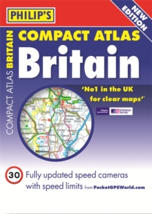
Image for Philip's Compact Atlas Britain

Philip's Compact Atlas Britain (Fifth edition)

See all formats and editions

"No.1 in the UK for clear maps." - Ordnance Survey Philip's road maps have been voted Britain's clearest and most detailed mapping in an independent consumer survey, and now show speed camera locations and their limits! The 287 pages of main road maps in Philip's Compact Atlas Britain 2014 are at the large scale of 3.3 miles to 1 inch (Scottish Islands at 6.7 miles to 1 inch), and include speed-camera locations.

The maps clearly mark service areas, roundabouts and multi-level junctions, and in rural areas distinguish between roads above and below 4 metres wide - a boon for drivers of wide vehicles. For leisure users, scenic routes are highlighted, and the maps show upland and highland areas as well as National and Forest Parks, and Areas of Outstanding Natural Beauty.

Long-distance footpaths, viewpoints, beaches, golf courses, campsites and caravan sites are clearly shown. Mapping specialists since 1834, Philip's celebrates over 165 years of global excellence in cartographic reference publishing.

The latest mapping technology ensures the World Atlases, best sellers for 100 years remain the most up-to-date on the market. The detailed Road Atlases, including those produced with national mapping agency, Ordnance Survey, are the first choice for Fire, Police and Ambulance Services throughout the UK.

Complete coverage of Great Britain at 3.3 miles to 1inch. 287 pages of clear, detailed road maps, including speed-camera locations. Includes a 6-page route-planning section.

Read More
Title Unavailable: Out of Print

The title has been replaced.To check if this specific edition is still available please contact Customer Care +44(0)1482 384660 or schools.services@brownsbfs.co.uk, otherwise please click 9781849075060 to take you to the new version.

This title has been replaced View Replacement
Product Details
Philip's
1849072698 / 9781849072694
Paperback
912.41
02/09/2013
United Kingdom
English
1 atlas (ix, 344 pages) : all maps (colour)
22 cm
General (US: Trade) Learn More
Previous edition: 2011.