Image for Road Atlas Britain

Road Atlas Britain

See all formats and editions

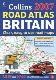
Presenting main road maps at 3.2 miles to 1 inch, this A4 format road atlas features clear, detailed road mapping with land height shown by attractive layer colouring.

A popular feature is the inclusion of a wide range of large scale urban maps of major towns and cities, plus town centre street plans.

Mapping includes speed camera locations. It is a handy A4 spiral road atlas, covering the whole of of Britain at a selection of useful scales.

This is an extremely handy format for the car, home or office.

The mapping has been updated fully for 2007. There are a number of new features this year, including speed camera locations, blue flag beaches and freight terminals, plus motorway slip road detail.

It includes: complete route planning section at 22 miles to 1 inch (1:1,408,450); main road maps at 3.2 miles to 1 inch (1:200,000); Northern Scotland at 4.2 miles to 1 inch (1:266,000); 20 urban maps at 1.4 miles to 1 inch (1:88,000); 61 fully indexed town and city centre street plans; blue flag beaches; full index to place names; and Ireland at 25 miles to 1 inch.

It is an ideal purchase for drivers, navigators and route planners who want the very best road atlas in an A4 format.

Read More
Title Unavailable: Out of Print
Product Details
Collins
0007224990 / 9780007224999
Spiral bound
912.41
07/08/2006
United Kingdom
English
xiii, 292 p.
30 cm
general Learn More
Main road maps at 3.2 miles to 1 inch. This A4 format road atlas features clear, detailed road mapping with land height shown by attractive layer colouring. A popular feature is the inclusion of a wide range of large scale urban maps of major towns and cities plus town centre street plans. Mapping includes speed camera locations. / Mapping includes speed camera locations. / Wide range of map scales makes light work of route planning. / The very latest road and detail changes for 2007. / Competition prizes include a Toyota Aygo and Cyclops Safety Camera detectors.
Main road maps at 3.2 miles to 1 inch. This A4 format road atlas features clear, detailed road mapping with land height shown by attractive layer colouring. A popular feature is the inclusion of a wide range of large scale urban maps of major towns and cities plus town centre street plans. Mapping includes speed camera locations. / Mapping includes speed camera locations. / Wide range of map scales makes light work of route planning. / The very latest road and detail changes for 2007. / Competition prizes include a Toyota Aygo and Cyclops Safety Camera detectors. 1DBK United Kingdom, Great Britain, WTR Travel maps & atlases