Image for London

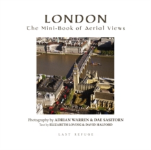
London : The Mini-book of Aerial Views

See all formats and editions

It was the Romans who built the first bridge across the Thames, and the network of roads that radiated from it to the far corners of Britannia brought a focus to the fort on the banks of the river that would become an important trading settlement and then a great port, using to advantage the ebb and flow of the daily tides to help heavily laden boats on their journeys.

London grew, quickly bursting out of its original town walls, as new settlements were created along the banks of the river.

During the time of the Saxon king Alfred the Great, in the 9th century, there were some 20,000 people here.

Then came the great buildings: King Edward the Confessor began the rebuilding of a Benedictine abbey west of the city at Westminster; William the Conqueror built the Tower of London; soon to be followed by St Paul's Cathedral and dozens of churches.As the centuries passed, royal palaces, civic buildings, trading centres and residential housing demanded an infrastructure of roads and water supplies, while farms in the surrounding countryside - the home counties - were depended on to feed the increasing population. The aerial photographs show the outlines and landmarks of the city as it grew; historic sites; great buildings, old and new; bridges, roads, and waterways; even housing developments that follow the shape of old field patterns, while the text distils the evolution of London through many different stages, together with its dramas of plague, fire and wartime blitz.

Emerging from this rich and chaotic history is a vibrant city, a frontrunner on the world stage, and arena for the 2012 Olympic Games.

Read More
Special order line: only available to educational & business accounts. Sign In
£9.95
Product Details
Last Refuge Ltd
0955866618 / 9780955866616
Hardback
01/12/2010
United Kingdom
432 pages, 420 pictures, maps and index
140 x 140 mm
General (US: Trade) Learn More