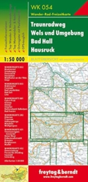
Image for Traunradweg - Wels- Und Umgebund - Bad Hall - Hausruck Hiking + Leisure Map 1: 50 000

Traunradweg - Wels- Und Umgebund - Bad Hall - Hausruck Hiking + Leisure Map 1: 50 000

See all formats and editions

Freytag & Berndt hiking maps are the perfect companion for hiking, mountaineering and ski touring, thanks to detailed digital cartography and precise yardsticks.

They are regularly revised and contain updated information on hiking trails, cycling and mountain biking trails, huts, natural monuments, cultural attractions and leisure facilities. The enclosed information booklet contains a selection of the best hiking trails, cycle paths and mountain bike trails as well as a short description of the individual municipalities with their leisure time activities. (Language: German)Leisure information, hiking and long-distance hiking trails, mountain biking and cycling tours, local register with zip codes, GPS-capable, via ferrata, ski route, cross-country route, Nordic walking trail;Region: Upper AustriaSpecial hiking theme trails:Austrian long-distance trail 06, Upper Austrian Mariazellerweg, Austrian long-distance trail 09, Salzsteigweg, Austrian long-distance trail 10, Rupertiweg, Donausteig, Jakobsweg, Marien-Wanderweg, Almuferweg "enjoyment on the Almfluss", Benediktweg, Schartner-Kirschblütenweg, via the Prinzsteig through the Linzer Pforte, from Dorf to village, Alt-Attnanger Rundwanderweg, to Viecht, circular path Hohenzell, trail Kulturweg, Hubertusweg, trail IrgerSpecial cycling and mountain bike tours:Donauradweg, Traunradweg, Römerradweg, Kremstalradweg, Almtalradweg, Voralpenradweg, Traunviertler Radweg, Trattnachtalradweg, Eferdinger-Landl-Radweg, Panorama-Radwanderweg, Pramtalradweg, Antiesenradweg

Read More
Special order line: only available to educational & business accounts. Sign In
£9.52 Save 20.00%
RRP £11.90
Product Details
Freytag-Berndt
3707917649 / 9783707917642
Sheet map, folded
01/10/2018
Austria
1 pages