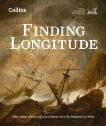
Image for Finding longitude

Finding longitude

See all formats and editions

Recommended for viewing on colour device.
Official publication of the National Maritime Museum's "Ships, Clocks and Stars" exhibition.

300 years ago, amidst growing frustration from the naval community and pressure from the increasing importance of international trade, the British government passed the 1714 Longitude Act. It was an attempt to solve one of the most pressing problems of the age: how to determine a ship's longitude (east-west position) at sea.

With life-changing rewards on offer, the challenge captured the imaginations and talents of astronomers, skilled craftsmen, politicians, seamen and satirists. This beautifully illustrated book is a detailed account of these stories, and how the longitude problem was solved.

Highlights of the book include:

- Foreword by the fifteenth Astronomer Royal, Martin Rees.

- Specially commissioned photographs from the National Maritime Museum's archive.

- A new description of the collaborations and conflicts in a tale of technical creativity, scientific innovation and hard commercialism.

From the same publisher as Dava Sobel's Longitude, Finding Longitude tells a new story of one of the great achievements of the Georgian age, and how it changed our understanding of the world.

Read More
Special order line: only available to educational & business accounts. Sign In
£20.00
Product Details
Collins Press
0007525877 / 9780007525874
eBook (EPUB)
527.209
10/07/2014
English
331 pages
Copy: 10%; print: 10%
Published in Scotland. Published in association with Royal Museums Greenwich Published to accompany the exhibition Ships, Clocks & Stars: The Quest for Longitude held at the National Maritime Museum Description based on print version record.