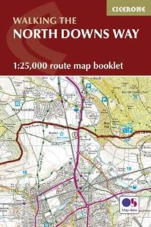
Image for North Downs Way Map Booklet

North Downs Way Map Booklet

See all formats and editions

A booklet of all the mapping needed to complete the North Downs Way National Trail between the high downland of Farnham, Hampshire and Dover on the Kent coast.

Covering 208km (130 miles), this gentle trail takes around 11 days to walk and is an ideal first long-distance hike for beginners. The full route line is shown on 1:25,000 OS mapsThe map booklet can be used to walk the trail in either directionSized to easily fit in a jacket pocketThe relevant extract from the OS Explorer map legend is included3-stage route detour via Canterbury is also providedAn accompanying Cicerone guidebook – Walking the North Downs Way – is also available, which includes a copy of this map booklet

Read More
Available
£7.46 Save 25.00%
RRP £9.95
Add Line Customisation
3 in stock Need More ?
Add to List
Product Details
Cicerone Press
185284955X / 9781852849559
Paperback / softback
15/11/2022
United Kingdom
96 pages
116 x 172 mm, 130 grams