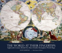
Image for The World at Their Fingertips : Eighteenth-century British Two-sheet Double-hemisphere World Maps

The World at Their Fingertips : Eighteenth-century British Two-sheet Double-hemisphere World Maps

See all formats and editions

Between 1680 and 1807 British publishers produced a sequence of double-hemisphere world maps each printed on two sheets and conjoined.

These maps are a peculiarly British phenomenon of this period and they provide a key indicator of the way the British map trade specifically targeted a newly prosperous and upwardly aspiring class of purchasers.

The buyers were hungry for geographical information, but were also eager to acquire such maps for display, as a statement of their intellectual pursuits.

The scientific appearance of the maps was more important as a selling point than standards of contemporary geographical accuracy, which few of them achieved.

This is the first time that this type of map has been studied as a genre, partly because of their great rarity.

The British Library holds the most comprehensive collection of these maps and studying them together has enabled the identification of broader themes.

In particular, a greater understanding of the British map trade in the 18th century, its business practices, the economics of map-making and new techniques of marketing emerges.

Read More
Title Unavailable: Out of Print
Product Details
0712358773 / 9780712358774
Hardback
912.42
10/07/2012
United Kingdom
256 pages, 100 colour, 50 black and white illustrations
310 x 240 mm
Postgraduate, Research & Scholarly Learn More