Image for Caribbean Wall Map

Caribbean Wall Map

See all formats and editions

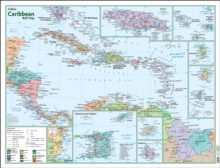
Fully updated colour wall map of the Caribbean showing each country and capital city, towns, major roads, railways and cities. Details of all of the key islands in the Caribbean with all major places of interest noted.

Call out panels highlight Jamaica, St Kitts and Nevis, Antigua and Barbuda, Monsterrat, Dominica, St Lucia and St Vincent and the Grenadines, Belize, Trinidad and Tobago, Grenada and Barbados.

Includes Caribbean regions of Latin America.

Read More
Available
£7.99
Add Line Customisation
Out of print
Add to List
Product Details
Collins
0008300402 / 9780008300401
Sheet map, folded
912.729
03/05/2018
United Kingdom
1 pages
887 x 1156 mm, 170 grams
General (US: Trade) Learn More