Image for Philip's Africa Reference Map (Physical)

Philip's Africa Reference Map (Physical)

Part of the Philip's Wall Maps S. series
See all formats and editions

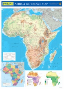
A brand-new wall chart showing the whole of Africa in physical colours.

The use of layer-coloured contours with hill-shading gives a highly-effective and accurate picture of the landforms across the continent, and the clear digitally-produced place names and symbols allow cities and towns, rivers, lakes and other physical features to be easily identified.

The map gives excellent coverage of the main transport - roads, railways and airports - making this map extremely useful either for study, reference or travel planning.

Accompanying the main map is a separate inset map showing the continent in political coloration, with countries picked out in bright distinctive colours to aid identification, together with colourful thematic maps showing annual precipitation and natural vegetation across Africa.

Philip's Africa Reference Map (Physical) is supplied in two versions: (a) laminated on both sides and rolled into a clear plastic tube for use as a wall map; and (b) unlaminated and folded with a tipped-on card cover for use when travelling

Read More
Title Unavailable: Out of Print
Product Details
Philip's
054008607X / 9780540086078
Sheet map, rolled
912.6
13/09/2004
United Kingdom
770 x 1070 mm
General (US: Trade) Learn More