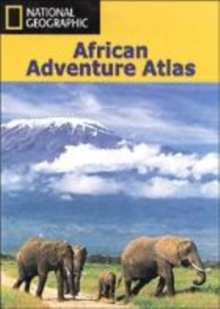
Image for An African Adventure Atlas

An African Adventure Atlas : NGAFR.AAA620500

See all formats and editions

This text divides the African continent into 15 geographical regions which are introduced over 30 pages and serve to lead the reader into the sections of the atlas, comprising National Parks, town plans and adventure activities.

For ease of reference, colour-coded "tabs" clearly identify the different secitons, which include: Morocco and the western Sahara; Algeria; Tunisia; Egypt and Sudan; Senegal; Gambia; Niger; Libya and Chad; Guineau Bissau to Benin; Nigeria to the Central African Republic; Gabon, Congo; Democratic Republic of the Congo and Angola; Rwanda; Burundi; Uganda and the Great Lakes Region; Kenya; Tanzania; Mozambique and Malawi; Zambia and Zimbabwe; Nambia and Botswana; South Africa; Lesotho and Swaziland; Madagascar, Comoros; and Mauritius.

An introductory section is followed by 40 pages of detailed, large-scale maps covering selected national parks highlight airfields, park camps, facilities and driving routes.

Detailed maps to the scale of 1:1,000,000 and 1:3,500,000 feature relief terrain and include border posts, airports, all major and minor routes and their distances, points of interests, trails and national parks/reserves. There are also detailed street plans of selected major African cities and towns, together with indexes.

The plans feature buildings and sites of interest, plus options for accommodation.

Six adventure activities are explored for each geographical region, from river rafting and hot air ballooning to hiking and pony trekking.

Read More
Title Unavailable: Out of Print
Product Details
National Geographic Maps
1566951739 / 9781566951739
Paperback / softback
912.6
05/09/2003
United States
English
336 p.
38 cm
general Learn More