Image for The German Air Force in Maps and Diagrams 1939-43

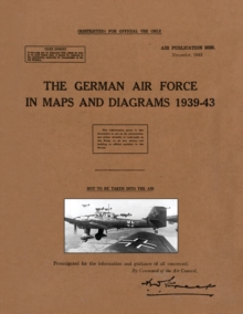
The German Air Force in Maps and Diagrams 1939-43

Air Publication 3038(Compiled by)
See all formats and editions

Air Publication 3038. November, 1943. 

(RESTRICTED) FOR OFFICIAL USE ONLY.

NOT TO BE TAKEN INTO THE AIR.


The intention of this official Air Publication was to provide an outline of the German Air Force from 1939 to 1943. Historically it focuses on the period in which the Germans were finding aggression successful. Published for training purposes, each map or diagram is complemented by a full and authoritative descriptive narrative. The publication is of much use for the air historian today, and bringing it back into print after 75 years will help the broad study of the Air War 1939-45.

This visual method was found useful by intelligence officers and includes sections relating to:

Operational Areas of Commands; Administrative & Supply Areas; Flying Units; Army & Naval co-operation; Air Transport; Supply & Maintenance; Signals; Training, each supported with interesting maps and/or diagrams. The work covers the Fronts in Europe, Russia and North Africa, with Appendices on Functions of the Luftflotten, Fliegerkorps & Lufgaus; Moves of the Fliegerkorps; Functions of Airfield Commands; Ground Organisation in North Africa (March, 1943); Flying Units & Their Mobility; Naval Co-operation & Air Transport (Employment of).


Read More
Special order line: only available to educational & business accounts. Sign In
£13.50 Save 10.00%
RRP £15.00
Product Details
Naval & Military Press
1474537537 / 9781474537537
Paperback / softback
08/02/2023
94 pages
216 x 279 mm, 240 grams
General (US: Trade) Learn More